Flüfpecks
Back in 2019 or so, my friend Mark asked me what I thought this image depicted. I was totally stumped and guessed fungal mycelia or birds. Drones? Terrible.
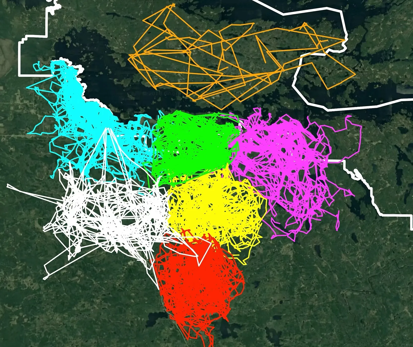
Nope, they’re wolf packs! 🐺 And the map shows how territorial wolves are. They created it “from 68,000+ GPS locations from 7 wolves in different packs during summer 2018.” The area here is the Greater Voyageurs Ecosystem which is a giant forest way up north in Minnesota.
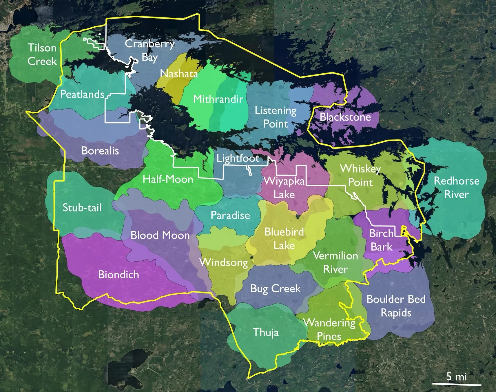
Here’s an updated version from 2023-2024.
Badass.